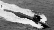
The exact position of SSN711’s grounding is classified but it is has been reported that the incident occurred approximately 360 to 400 miles southeast of Guam. Additionally the National Geospatial-Intelligence Agency has reported that a “discolored waters area” that appears on a 1999 Landsat satellite image could be a previously uncharted seamount. The position of the “discolored waters” area in question is reported as 7° 45.1’ N Latitude and 147° 12.6’ E Longitude. Guam, where the USS San Francisco started its voyage, position is 13° 27’ N Lat and 144° 13’ E Long.
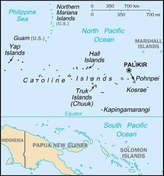
Micronesia (Source: CIA - World Factbook)
Each degree of Latitude is 60 nautical miles and at 10 degrees Lat each degree of Longitude is still 59 nautical miles (Cos Longitude x 60). Using pythrethrum theorem A2 + B2 = C2 we can verify the distance between Guam and the Seamount. Where A is the difference in Lat miles (13 – 7) x 60 = 360 miles and B being the different in Long mile (147 – 144) x 59 = 177 miles we can calculate the diagonal distance. I came up 401 nautical miles between Guam and the reported Seamount position. I hope I did the math right on this, but it matches the upper end of the reported distance from Guam where the sub grounded. This is essentially the area between Guam in the Marianas Islands and Caroline Island ridge of Micronesia.
The area transited by SSN711 has some of the most extreme changes in bathymetric topography in the world. In fact Marianas Trench just southeast of Guam has the deepest point in the worlds oceans at 38,518 feet deep. To put that in perspective the elevation of Mt. Everest is only 29,035 feet above sea level. As an illustration I included the below hydrographic image of the western pacific that include the sub's transit route.
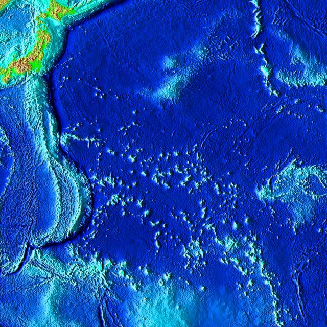
Pacific Bathymetry relief (Source: National Geophysical Data Center)
In the below image I took a section of the above NOAA relief and given reference location of Guam and the Latitude of 0° for the bottom of the image I was able to create a very rough illustration (yellow box in next image) of where the sub could have struck the seamount. Click on any image for a larger view.
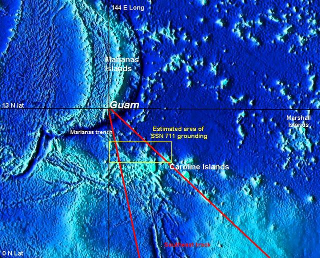
Hydrographic with SSN711 estimated track (Modified subsection of previous relief)
I took three reported facts into account in adding my notations above. First the general direction of the ship’s transit was on a southeast heading. Second the distance of 360 to 400 nautical miles from Guam and last the accident occurred before reaching the Caroline Island Ridge. Now none to this is exacting only my best guess. The actual position could be a little further south than I indicted.
Seamounts and Guyots are volcanic in origin and the Marianas chain is volcanically active. A large number of the Caroline Islands are also volcanic in origin but do not have any active volcanoes. The Caroline Islands did have a 5.8 earthquake in 1998.

South Pacific Volcano breaking ocean surface. (Source: Volcano World website)
This photograph was taken by CSIRO - Australia.
The above photo although not from the area of the grounding does show how an active underwater volcano can abruptly appear. The underwater topography of the western pacific is a dynamic and changing environment.
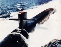
The damage to the sub from the grounding was significant and appears to come from what could have been a near vertical face of the seamount.

USS San Francisco damaged bow section. (Source: US Navy Photo)
So what do the charts say about the area in question? I was unable to find any Navgation charts of the western pacific at my local boatyard ship's store and had to order a chart on-line . I haven't recieved that chart as of this writing. I did look into what commercial charts cover the USS San Francisco's transit route. The following are the NIMA chart numbers and Notice to Mariners of possible interest:
Chart# Ed# Notice to Mariners
81002 6 30/1990, 43/1995, 24, 42/1996, 18/2002 --- Caroline Islands Western part
81004 4 06/2005 --- Marianas Islands
81023 5 42/1989, 12/1990, 01, 34/1993, 41/1995, 10, 46/1996, 18/2002, 06/2005--Nomoi Islands
81025 3 N38/2004 --- Military use only
81133 4 47/1985, 27/1986, 15/1988, 30/1989, 15/1991, 06, 14, 34/1993 --- Caroline Islands
It will be interesting to see what information is contained in the listed charts and Notice to Mariners. It should be noted though, that reports of the Navigation crew's NJPs cited negligence in chart maintenance, but never indicated that a specific piece of missed information would have prevented the grounding.


No comments:
Post a Comment