Encl: (137) USNS HESS 1980 Survey Data in vicinity of grounding (S)
The USNS HESS was a T-AGS class ship tasked specifically for deep ocean hydrographic surveys. The kind of survey work these ships do would provide information that could have prevented the grounding if known. The USNS HESS (T-AGS-38) was fitted with a SASS 1 x 1 degree Multibeam Sonar system for this type of survey work.
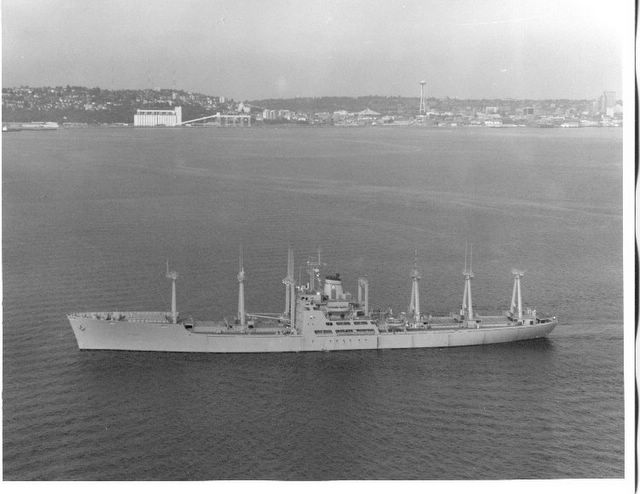
USNS Hess T-AGS-38
(Source: NavSource.org - Carl R. Friberg Jr.)
The fact that this enclosure is in the list brings a few questions to my mind.
- What exactly is "in vicinity of grounding" mean?
- Did the area of the grounding get surveyed for a specific purpose and then that information not get transferred?
- If the USNS HESS survey data was not applicable why look at it?
The survey work done by the USNS HESS was in 1980, back then SSBNs still made patrols out of Guam. If the seamounts and escarpments "in the vicinity" were surveyed back in 1980 then 25 years is a long time for that data not to make it on operational submarines bottom contour charts.
Then again I could be wrong and they were just out fishing.
Update: 5/11/05 -11:50 Under the section "Chart Cautions and Accuracy" paragraphs 508 thru 511 reference encl:(137) but are remove to provide an unclassified document. What is interesting is the statement in paragraph 507:
NGU report that "None of the depicted track lines [on E2202] appear to have ensonified the feature in question." [encls (43), (232) ]
This statement precedes the USNS HESS hydrographic references in 508 -511.
I'm not trying to create a conspiracy here, just try to point out that hydrographic data comes from a variety of sources, some classified. If there was a failure here then perhaps there needs to be a review of methods used to incorporate clear hazards to navigation and submerged operations onto general navigation and bottom contour charts.


4 comments:
Dennis, I appreciate you bringing your experience to the conversation and reinforcing my point on reviewing methods used to incorporate hazards to navigation onto general navigation and bottom contour charts.
I also agree with you on a problem I would call “loss of institutional memory” where experienced personnel are replaced by contractors who may last one or two contract cycles of 2 or 3 year duration. The contractor is then outbid and replaced by an almost completely new set of people. I saw this in the Defense contracting world when I was one of those contractors. The long term government GS knew a hell of a lot more about his job than I did. In the short term it saved the government money to be able to hire and fire contractors when work levels and funding changed. But in the long term it cost when the efficiency and knowledge of those contractors dipped with each contract re-bid.
As far as machines doing the data processing and decision making, being a technology person, I’m of the opinion that programmed functions can improve the efficiency and throughput of almost any process. But machines do simple repetitive things really well and complex things not so well. The same simple error repeated many times by a computer can have a consequence far worse than a single but larger error created by a human.
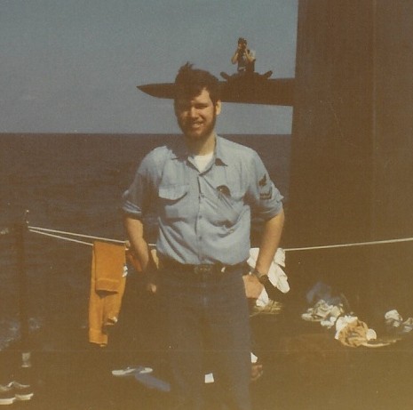
I was stationed on Hess for most of 1980 as a member of the U.S. Navy Oceanographic Unit which ran the navigation and sonar centers that produced the raw data for the oceanographic charts and other products. All I can say is that the Hess did indeed spend time surveying south of Guam while I was onboard though I don't recall where exactly. I remember we crossed the Marianas Trench on our way to port. Our surveys ran a month at sea and then a week in port. We spent one week in Guam that year--in August, I think. Hottest place I've ever been. I remember our most southern surveys were just north of the equator. We did discover some seamounts while I was onboard but I don't know if any of these were discovered in the time we spent just above the Equator versus some of the more northerly surveys. I have no idea whether our data made it into NOTAMs or new charts but it was certainly supposed to. It would make complete sense to me that an investigation into the SF grounding would include a review of the data Hess produced because the apparent cause of the accident was an unknown seamount and if Hess had indeed surveyed that area and had found that seamount then there would have been some hell to pay inside of NAVOCEANO. I hear what Dennis is saying about priorities but if an uncharted seamount with a summit at a depth less than at least the test depth of our deepest diving boats and less than 400 miles from a frequent submarine port of call wasn't a priority I don't know what is, and the SF incident proves that. I served on a boomer as an officer some time after my enlisted tour on Hess and gained an entirely new appreciation for quality charts after the other crew went aground at a pretty serious depth. In that case the problem wasn't the chart itself but a breakdown in paying attention. The boat suffered some minor equipment and cosmetic damage but was very lucky to have hit a muddy bottom at almost zero bubble while pulling up from a fairly steep dive at standard speed.
THE SASS OF TAG'S HAS 144 RECEIVE ELEMENTS OF WHICH 90 MOST VERTICAL ARE SELECTED DEPENDENT ON ROLL. THE TRANSMIT ELEMENT CONSISTS OF 24 6 PACKS IN A FORE TO AFT ALIGNMENT AND SEND OUT A TIME DELAYED BEAM TO BE MOST VERTICAL. YOUR DESCRIPTION OF 1 DEGREE ALL DEPENDS ON WATER DEPTH. THE ACCURACY IS BETTER THAN 6 INCHES AT 10,000 FT MAKING A MAP OF THE BOTTOM TOPO.
Modern online oulet http://www.stylebreath.com/ selling fashionable clothing and boots for men and women has been opened. theses days we carry out a number of marketing actions. in this respect we invite all the SEO specialists who are interested in cooperation. We look for:
1. positioning of our ads on sites. Relevant sites will be considered primarily
2.Buying of links from reputable websites and from the sites related to our niche
3.purchasing of the niche related traffic.
collaboration with bloggers and social sites
if you have any offers pm at info[at]stylebreath.com
Post a Comment