Tuesday, June 07, 2005
Protesters breach Faslane Trident Base - almost
Thirteen campaigners were arrested, one of whom had climbed 30ft up a tree, after cutting through a perimeter fence and entering HM Naval Base Clyde. One campaigner remained up the tree last night.
The protesters entered the Faslane base, home to the Trident nuclear submarine fleet, at about 11pm on Monday.
The base was closed for several hours while MoD police rounded up the intruders. They were arrested on suspicion of malicious mischief and bailed.
Police then attempted to coax two campaigners down from a tree inside the complex. A spokesman for the MoD police said one man climbed down and was arrested. "The other man still remains up the tree," he added.
(My emphasis above)
Their main protest is against the British Trident submarine fleet based at Faslane.
But not everyone in Great Britain is in agreement with the protesters as witnessed at The Weekly Grip weblog.
I never knew Scotland had nut trees or is that nuts in the trees. Then again nuts are an ingredent of Scottish Fruitcake.
Crossposted to "Ultraquite No More"
Monday, June 06, 2005
Going Vertical on builders trials

Emergency Blow (Source: US Navy)
It was a wild ride.
Sunday, June 05, 2005
Taming the BST

Taming the BST buoy
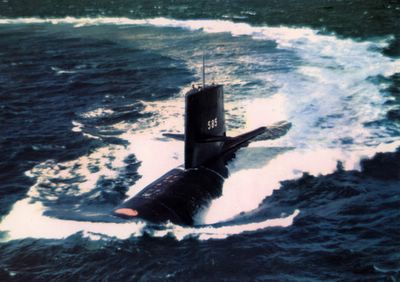
Rescue buoy painted orange on the USS Skipjack
(Photo source: US Navy and Navsource.org)
The submarine rescue buoy has saved lives in the past. The later BST buoy will probably just mark the location of a tragedy, that is if it not welded to the deck. But I'm afraid there is another beast that lives in the ocean's depths that we should look to tame.
In 1953, unwelded by an atomic blast in the arctic, "The Beast from 20,000 Fathoms" made Manhattan it's own little project.

This other beast from the deep started all those Atomic sized monsters of the 1950's and 60's "B" movies.
Of course what's in a name anyway BST or beast, to me it's no reason to go nuclear.
Thursday, June 02, 2005
New Submarine Group Blog -crosslink
I've posted about the new Virtual Periscope system in development over at the new site.
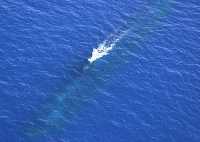
USS Chicago at PD (Source: US Navy - PH1 Kevin Tierney)
If you want to read more here's the link to my posting.
Tuesday, May 31, 2005
Submariner in Space?

Navy Cmdr. Stephen Bowen (Source: NASA)
USS Parche (SSN 683), USS POGY (SSN 647), USS Augusta (SSN 710) and the Pre-Comm Unit for the Virginia (SSN 774) for a total of 14 years in the Submarine Service before becoming a Mission Specialist at NASA.
I have to say those gold Dolphins do make the NASA uniform look good.
Sunday, May 29, 2005
RI locals stunned by the obvious.
Saying RI is a small state is well, an understatement, and much of what happens in CT or MA has a direct impact on this State. Economic impact does not stop at the CT border and many people in southern RI make the 30 to 45 minute commute to work in Groton. Now the premere local business publication The Providence Business News has reported the obvious as well: Groton submarine base closure makes waves in the Ocean state (hat tip: TheSubReport).
The closing of the New London Sub Base would remove one of the incentives the Navy has to award Submarine contracts to Electric Boat. After all where would you keep all the PCU and overhaul crews as well as the Navy's shipyard detachment personnel, a hour plus away in Newport?
Engineering Heavy Weight
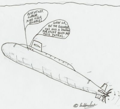
When there's no room to maneuver in Maneuvering perhaps Shipshape is the answer!

A Submariner's favorite - Sticky Buns.
They go really well with a tall glass of bulls milk and some powdered eggs about day 60 of patrol, NOT. I did like the sticky buns at breakfast though.
***** Lubber's Comic *****
I'm not much of an artist but I do like to doodle some. So I thought I would add a Sunday comic to my Blog just for fun. Sort of in the above format, an obscure submarine reference or bad pun in a doodle followed by some additional obscure or bad referenced information. Did the same last week. We'll see how it works out.
Friday, May 27, 2005
Sub Base New London Closing Criteria?
Much of what the DOD and Navy has provided to date lacks detailed justification but does fit the broad outline of the Under Secretary Of Defense Jan 2004 memorandum Subject: 2005 Base Closure and Selection Criteria. The following is a list of those Criteria:
Military value
- The current and future mission capabilities and the impact on operational readiness of the Defense Department’s total force, including the impact on joint warfighting, training, and readiness.
- The availability and condition of land, facilities, and associated airspace (including training areas suitable for maneuver by ground, naval, or air forces throughout diversity of climate and terrain areas and staging areas for the use of the Armed Forces in homeland defense missions) at both existing and potential receiving locations.
- The ability to accommodate contingency, mobilization, surge, and future total force requirements at both existing and potential receiving locations to support operations and training.
- The cost of operations and the manpower implications.
All of the above criteria speaks to me of consolidation to even larger military multi-branch and multi-discipline installations. The more remote the area, free of congested sea lanes and air space, the better. Additionally the costs associated the local economy such as cost of living, per diem, facility maintenance and heating/AC costs all contribute to the bottom line in cost savings to the military and its personnel.
How do the New London Sub Base supporters counter the consolidation and better local economic climate justifications? One method I’ve seen is to use the simplistic “is it really that much better” argument. Basically the argument says that Norfolk and eastern VA are economically similar and just as congested to eastern CT. Not a very good standpoint to take, sort of like saying my house is just as ugly as yours only smaller. Another point that has been made is to cite history, partially the Pearl Harbor Attack as a reason not concentrate too much of the military to one region or at one base. A fair point to make but when someone is concentrating on the bottom line of a spreadsheet it’s hard to get them away from the dollars mindset.
The real arguments should be attacking the driving forces behind the DOD and Navy’s rational in the base closing recommendation, those being cost saving, projected submarine force structure requirements and military force transformation. Already some of the cost estimates have been put into question such as what a full environmental cleanup of the Sub Base would require. Additionally much of the facilities at the New London Sub Base, such as the Sub School, do not exist elsewhere and would have to be built. Facilities that do exist in Kings Bay or Norfolk would also have to be expanded. Indeed Norfolk may or may not have a current excess of piers and office space due to a reduced fleet size but the Brac Commission is already reviewing other space in VA to accommodate the closing of both New London Sub Base and Portsmouth Naval Shipyard.
The Navy’s projected force structure requirements are also being called into question. Essentially a recent Navy study has revised upward the number of operational Submarines it needs from between 37 and 41 to as many as 45 to 50. That’s only 4 boats less than 54 in service today. Numbers wise there are currently 21 subs based out of Groton including 1 PCU, 13 out of Norfolk including 2 PCUs and 8 SSBNs out of Kings Bay, thats relocating nearly half the submarines on the east coast. If Groton represents such excess capacity why are more than half the SUBLANT Fast Attacks based there? At face value excess pier space in Norfolk doesn't look like a very good reason to move over half the boats and supporting facilities south.
Transformation and network centric warfare are the current go to concepts that the DOD is working on. Basing a number of different services and types of units in one place may help facilitate training for those locally based units but doesn't it also defeat the overall purpose of those concepts? Namely being able to take different units that may be based across a wide geographic area and cross multiple disciplines and have them work together seamlessly.
Other considerations
These other considerations are where the politicians seem to focus their attention, mainly the economic impact. This means votes to them because their constituencies demand they defend the status quo. It’s a no brainer to cite the fact that an employer with a multi-million payroll leaving is going to effect the local economy. Placing too much attention to the lower priorities of the selection criteria and not enough to the Navy’s main justifications could prove fatal. The Navy will defend its position by citing the overall saving the closures will provide to the DOD and additionally cite other communities that have recovered after their bases have closed. For example a Navy Times editorial points to a recent GAO report (PDF) as such an economic justifaction.
If you look close though at the above referenced GAO report you’ll find that many communities that had significant naval base closures have not recovered very well. Here are three examples of facilities that had provided submarine support activity at one time.
Charleston Naval Complex, S.C. -BRAC 1993 -EST jobs lost 6,272 -Recovered jobs 2,797 -Recovery 45%
Guam Naval Complex BRAC 1993 EST jobs lost 2,193 -Recovered jobs 552 -Recovery 25 %
Mare Island Naval Shipyard, Calif. 1993 -EST jobs lost 7,567 -Recovered jobs 1,363 -Recovery 18%
What is Going Where? Below is from the Navy’s Analyses and Recommendations VOL IV (PDF) page 65.
Recommendation for Closure
Submarine Base New London, CT
Recommendation:
Close Naval Submarine Base New London, CT. Relocate its assigned submarines, Auxiliary Repair Dock 4 (ARDM-4), and Nuclear Research Submarine 1 (NR-1) along with their dedicated personnel, equipment and support to Submarine Base Kings Bay, GA, and Naval Station Norfolk, VA. Relocate the intermediate submarine repair function to Shore Intermediate Repair Activity Norfolk, at Naval Shipyard Norfolk, VA, and Trident Refit Facility Kings Bay, GA. Relocate the Naval Submarine School and Center for Submarine Learning to Submarine Base Kings Bay, GA. Consolidate the Naval Security Group Activity Groton, CT with Naval Security Group Activity Norfolk, VA at Naval Station Norfolk, VA. Consolidate Naval Submarine Medical Research Laboratory Groton, CT, with Naval Medical Research Center at Walter Reed Army Medical Center Forest Glenn Annex, MD. Relocate Naval Undersea Medical Institute Groton, CT to Naval Air Station Pensacola, FL, and Fort Sam Houston, TX. Consolidate Navy Region Northeast, New London, CT, with Navy Region, Mid-Atlantic, Norfolk, VA.
Justification:
The existing berthing capacity at surface/subsurface installations exceeds the capacity required to support the Force Structure Plan. The closure of Submarine Base New London materially contributes to the maximum reduction of excess capacity while increasing the average military value of the remaining bases in this functional area. Sufficient capacity and fleet dispersal is maintained with the East Coast submarine fleet homeports of Naval Station Norfolk and Submarine Base Kings Bay, without affecting operational capability. The intermediate submarine repair function is relocated to Shore Intermediate Maintenance Activity Norfolk at Norfolk Naval Shipyard, and the Trident Refit Facility Kings Bay, GA, in support of the relocating submarines. Consolidating the Naval Submarine Medical Research Laboratory.
The Navy spent 1.3 Billion over 10 years to develop the Submarine Base in Kings Bay GA. and now plans a major expansion to save the Navy of $1.6 billion over 20 years. Also you can't spit in the Tidewater area of VA without hitting something with a MILSPEC tag on it. So this all makes sense to me, how about you?
Update 5/27/05 8:30- Former Submariners Bubblehead and PigBoatSalior have been covering the Sub Base New London closing news pretty heavy lately and have some good posts on the subject. You should swing by their Blogs for some additional info.
Wednesday, May 25, 2005
USS Alabama SSBN731 - 20 Years Today
First is the commissioning program book below. It's about 20 pages and includes description of the commissioning of the ship, history of other ships named after the state of Alabama, individual photos of crew members and profiles on the Commissioning Officials and each crews Senior Officers and Enlisted. I've only included the cover and program page.
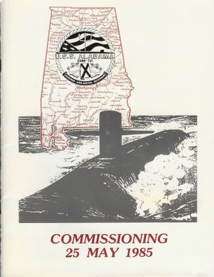
Commissioning Program Cover
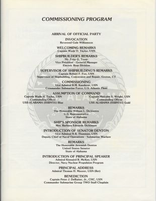
Commissioning Program Agenda (Source: a dusty sea bag in the attic)
The second is this souvenir envelop from that day.
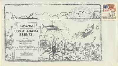
Commissioning Souvenir Envelop (Source: that same sea bag)
The Commissioning of a ship is when it officially becomes a "United States Ship" and can hold the prefix "USS". Until that time it can only be called a Precomm Unit (such as precomm unit Alabama) or by it's hull number (such as the 731 boat).
The inside cover of the commissioning program also has this description.
The Commissioning ceremony marks the acceptance of a ship as a unit of operating forces of the United States Navy. At the moment the commission pennant is broken, USS ALABAMA (SSBN731) becomes the responsibility of the Commanding Officer, who, together with the ship's officers and men, has the duty of making and keeping her ready for any service required by our nation, whether we be at peace or at war.
Before Commissioning the Officers and Crew work hard to put the ship through a series of builder trials and acceptance testing, as shown in this Alpha Trials photo. We did our sea trails in mid winter hence the orange foul whether gear on the bridge.
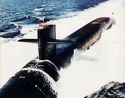
The Alabama on Alpha Trials (Source: US Navy Photo)
The USS Alabama has served the United States Navy well for the past 20 years and will do so for perhaps another 20.
The Official State and Ship's Motto"AUDEMUS JURA NOSTRA DEFENDERE"
Lubber's Line - USS Alabama (Plankowner)
Sunday, May 22, 2005
Snorkel Mask
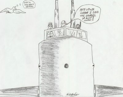
Snorkel Mask or Snorkel Mast?
A little sound to bring back some bubblehead memories (wav).
There's a great web site USS Caiman (SS-323) Association where I found a whole series of control room and sonar shack sound bites. I liked this one which may be why STS's prefer passive sonar.
Wednesday, May 18, 2005
Men of Integrity and Courage
Cmdr. Mooney has done what many a Commanding Officer before him has done and taken full responsibility for what has happened aboard his ship. In doing so the Commander has demonstrated integrity that is rare outside of the military and seems almost non-existent among our captains of industry. A letter of reprimand has essentially dead ended his naval career. But Cmdr. Mooney should know that he has done what few men would or could do, that is, taken on the responsibilities of command of a U.S. Navy nuclear fast attack submarine.
The crew’s actions to save their crippled ship, to tend to their injured shipmates and attempt to save the life of critically injured MM2(SS) Joseph Allen Ashley demonstrated the courage that is only found in dedicated and confident men. Throughout the grounding’s investigation the crew of the USS San Francisco has stuck together and only asked that the truth lead where it may to benefit others who operate in a similar submerged environment. Therefore the crew has shown additional courage in voicing their belief that the grounding’s responsibility must also include those who provide the systems and information that every submarine relies on.
You may think I’m glossing over any failures that caused the grounding but what I wanted to provide here was only my observations on the demonstrated character of the men of the USS San Francisco SSN 711. These observations are why I still proudly say “I once wore the silver dolphins of the US Submarine Service”.
Lubber’s Line
Former NavET ET1(SS)
SSBN 641, SSBN 731
Sunday, May 15, 2005
Cookiecutter Sharks and Submarines
I was watching a show about sharks with my son recently and a strange little shark was mentioned, the Cookiecutter shark. A small species of deep ocean dogfish the Cookiecutter shark has a bioluminescent underbelly and short, powerful jaws.
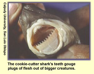
This shark also has a reputation for it's distinctive bite.

Bite damage (Source: NOAA)
It is known for biting out small plugs of flesh from large fish and whales as well as damaging undersea cables. But the thing I found interesting is that it has been known to attack nuclear submarine sonar domes. Here's a conversation from an Australian website on the topic.
I have to say the sea is full of some strange creatures, including the ones outside the pressure hull.
Friday, May 13, 2005
Friday the 13th BRAC ATTACK
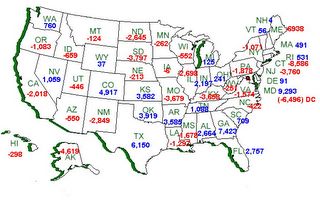
BRAC net totals both Military and Civilian jobs by State.
(Click on Image to enlarge)
So who are the big winners as a result of Sub base NL and PNS closing (Not Realigned)? Georgia has one of the biggest numbers in the plus column with 7,423 of which 3,367 go to the Submarine Base Kings Bay.
The other State where the Sub Base NL and PNS jobs are going is likely to be Virginia with gain of 2,036 to Naval Shipyard Norfolk and 2,807 to Naval Base Norfolk , but Virginia shows a net loss. I found a single line item that throws the numbers off for Virginia (Leased Space -VA Close/Realign -22,925). Thats a lot of "leased space" in VA seeing how all the other states combined have "leased space" totaling -3094 positions. If you take the -22,925 out of the equation Virginia gains 21,351 jobs. I guess the military leases a lot of administrative office space outside of DC. But if that were so why is it that VA has -22,925 lost jobs and MD only -175 attributed to "leased space"?
Let's look at the Brac Commission members and how the States they hail from did.
- Anthony J. Principi, former secretary of veterans affairs, from CA, chairman. ( -2,018 not bad for a big State)
- Former Rep. James H. Bilbray of NV. ( 1,059 in the plus side)
- Former Assistant Defense Secretary Philip Coyle of CA. ( -2,018 can't show any bias there's two from CA)
- Retired Adm. Harold W. Gehman Jr. of VA. ( - 1,574 or is that +21,351 I'm not sure...)
- Retired Air Force Brig. Gen. Sue Ellen Turner of TX. ( 6,150 and the boss will probably say OK)
- Former Rep. James V. Hansen of UT. ( -446 didn't hurt that much)
- Retired Army Gen. James T. Hill of FL. ( 2,727 another one on the plus side)
- Samuel Skinner of IL, former chief of staff for President George H.W. Bush. ( -2,698 mostly Naval Station Great Lakes)
- Retired Air Force Gen. Lloyd Warren Newton of CT. ( -8,586 whatever the Adm. says is OK)
Some would say the New London Sub Base and Naval Shipyard Portsmouth closures are a good thing such as linked here or here and others a bad thing as linked here or here. But there's something to be said for Yankee toughness and the people in the Northeast who support these installations aren't going to go away.
Then again Norfolk is such a much nicer place that Groton and Kings Bay is a great place to be in August.
By the way, did I say I'm from Rhode Island about half way between where the Navy once had all types of large installations and that Submarine Base in CT they're going to close. I don't really have a dog in this fight just an interested party that lives nearby.
Wednesday, May 11, 2005
SSN 711 grounding position on chart 81023
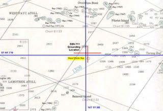
Chart 81023 plot of SSN 711 grounding
(Click on Image to enlarge)
There are two positions in the report, the ship's deck log position and the RLGN data position. Plotted in Blue for deck log and Red for RLGN recorded positions. Here are the report entries:
290. (U) The QMOW on watch at the time of the grounding, ET2(SS) ****, said he was knocked unconscious for a short time when the ship grounded. According to the ship's Deck Log, the Grounding occurred at 07 44.7' N, 147 11.6' E. A relieving QMOW, ET2(SS) **** , stated that this Deck Log position was taken from the RLGN remote touch screen display that was paused some time after the grounding.
291. (U) Based on a second-by-second analysis of the ship's deceleration recorded in RLGN channel 1 data, the ship grounded at 1142K (and 20 seconds) at 07 45.5' N, 147 12.3' E.
The Chart I used above is 81023 which is a general navigation chart and the one the Navy cites as containing the "discol waters rep". The Discolored Waters Report is 3 nautical miles south of the actual grounding and is from a 1966 Japanese Notice to Mariners that was originally reported in 1963. This data point was not on the E2202 chart used by the Navigation crew and was not noted in the SUBNOTE provided for their transit. Chart E2202 is a bottom contour chart and was considered to have been more accurate due to the greater density of sounding data. I noted chart 81023's poor sounding data in a previous post on this blog. Chart E2202 was up to date and the Navigation crew had all applicable NTM entered.
Although not transferring the "discol waters rep" from Chart 81023 to E2202 was cited as one of the contributing factors to the grounding, it is not a responsibility the Navigation crew shares alone. I'm of the opinion that the originator of the SUBNOTE and the Defense Mapping Agency share equal responsibility for not including on chart E2202 a navigation hazard identified back in 1963.
Tuesday, May 10, 2005
SSN 711 Grounding Report Encl:(137) USNS HESS
Encl: (137) USNS HESS 1980 Survey Data in vicinity of grounding (S)
The USNS HESS was a T-AGS class ship tasked specifically for deep ocean hydrographic surveys. The kind of survey work these ships do would provide information that could have prevented the grounding if known. The USNS HESS (T-AGS-38) was fitted with a SASS 1 x 1 degree Multibeam Sonar system for this type of survey work.
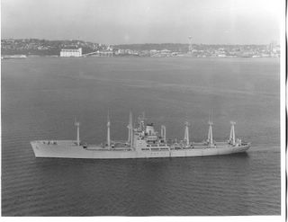
USNS Hess T-AGS-38
(Source: NavSource.org - Carl R. Friberg Jr.)
The fact that this enclosure is in the list brings a few questions to my mind.
- What exactly is "in vicinity of grounding" mean?
- Did the area of the grounding get surveyed for a specific purpose and then that information not get transferred?
- If the USNS HESS survey data was not applicable why look at it?
The survey work done by the USNS HESS was in 1980, back then SSBNs still made patrols out of Guam. If the seamounts and escarpments "in the vicinity" were surveyed back in 1980 then 25 years is a long time for that data not to make it on operational submarines bottom contour charts.
Then again I could be wrong and they were just out fishing.
Update: 5/11/05 -11:50 Under the section "Chart Cautions and Accuracy" paragraphs 508 thru 511 reference encl:(137) but are remove to provide an unclassified document. What is interesting is the statement in paragraph 507:
NGU report that "None of the depicted track lines [on E2202] appear to have ensonified the feature in question." [encls (43), (232) ]
This statement precedes the USNS HESS hydrographic references in 508 -511.
I'm not trying to create a conspiracy here, just try to point out that hydrographic data comes from a variety of sources, some classified. If there was a failure here then perhaps there needs to be a review of methods used to incorporate clear hazards to navigation and submerged operations onto general navigation and bottom contour charts.
Sunday, May 08, 2005
Tin-foil Central with Satire
In the spirit of tin-foil hats I decided come up with my own theory on the French “documentary” theory. (Read on only if you know what satire is.)
Satire On...
Headline: French source of anti-American propaganda found.

Tin-foil Central (Webmaster –baiter and IP switcher)
The Lubber's Line investigative service (LL-IS) has discovered the source of much of the anti-American propaganda emanating from France. After months of tracing back IP addresses and Internet service providers, LL-IS has discovered that the majority of this material came from the PC pictured above. The IP trackback was difficult and included the UN’s mainframe, a server hosting CBS news email, a PC in Flint Michigan, a server in Damascus Syria and finally the above workstation in a French Pharmaceutical company outside of Paris.
Emmanuel Lo Botomy is the webmaster and above cube occupant. Mr. Lo Botomy works for a French company that manufactures psychotropic drugs for the socialized medicine market.
Emmanuel confessed that he held a grudge against Americans ever sense he was fired from his Euro-Disney job back in 1998. During this reporter’s interview with Mr. Lo Botomy he constantly referred to the two adjacent co-workers as Lilo and Stitch. The one identified as Stitch said Emmanuel had not been well ever since he spilled espresso on his keyboard and a blinding blue flash had followed.
Emmanuel also commented that Stitch's mothership resembles a submarine.
Satire Off…..
Friday, May 06, 2005
Frigate Bird May 6, 1962 23:30 (GMT)
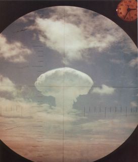
Frigate Bird Test (Source: US DOE)
The USS Ethan Allen (SSBN-608) launched a Polaris missile in the afternoon of May 6 1962 towards the Christmas Islands in Eastern Micronesia. The warhead went down range approximately 1,100 miles before re-entering the atmosphere 12 to 13 minutes later. The 600-kiloton airburst occurred at 11,000 feet above 4° 50' North, 149° 25' West . The DOE website has a file film download page of the Frigate Bird test.

USS Ethan Allen SSBN 608 (Source: US Navy)
The Frigate Bird test was part of a the largest U.S. Nuclear testing operation ever conducted, Operation Dominic, with 36 atmospheric tests at the Pacific Proving Grounds.
In other news today "U.S. Warns North Korea Against Nuclear Test" in the NYT (Subscription) and "N. Korea nuke test preparations" at CNN website. The successful Frigate Bird test was 43 years ago, the North Koreans shouldn't rattle those sabers too loud I would think.
The Frigate Bird is also known as the Man-O-War Bird.
I also liked this quote:
"You can't be a real country unless you have a beer and an airline. It helps if you have some kind of a football team, or some nuclear weapons, but at the very least you need a beer. " Frank Zappa
Had any good North Korean beer lately?
Update 5/7/05 - 9:30: the above Periscope photo shot is from the USS Carbonero (SS-337) 480 nm ENE of Christmas Island. 14:45: Another update to correct sleepy eyed typos and misspellings.
Wednesday, May 04, 2005
Weakest of Links
The first one is this story I read about the Portuguese Navy purchasing some new Type-209MOD submarines fitted with the latest fuel cell propulsion equipment. But then I ran across this story about jolting bacteria to make hydrogen from human waste. Hydrogen is the FUEL in fuel cells so could SAN #1 someday become a fuel source? No more blowing sanitary tanks at sea. Brings a whole new meaning to all AHEAD FULL.
Here’s a story from the Woods Hole Oceanographic Institute about recent discoveries in ocean water layering with “salt fingers” and temperature gradients. Seeing how submarines have been known to take advantage of thermocline effects on sonar to avoid detection, a DEEPER understanding of the ocean’s temperature gradients and salinity could help tactics.
Speaking of detection here’s a story about using Muron Radiography to find nuclear materials even within substantial shielding. Could this new technology be adapted to find Nuclear Submarines as sea? Probably not, but at least we could use the technology to find nuclear wantabe terrorist MORONS with a Muron detector.
I did say they were weak.
Sunday, May 01, 2005
Ghost Nets – silent curtains of death
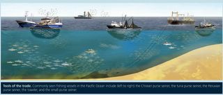
Common type Trawler fishing (Source: NOAA)
The NOAA researchers have developed a new method of using Satellites and a NOAA P3 aircraft to locate possible convergence zones. In an operational test this past March NOAA researchers were able to confirm their method on one such convergence zone north of Hawaii. The area they found contained about 2000 separate pieces of debris, including balls of nets up to 10 meters across.
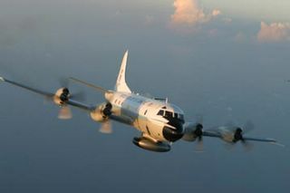
NOAA WP-3D Orion (Source: NOAA)
According to the Hawaii Sea Grant, a federal cleanup of Hawaiian Islands two years prior collected some 100 tons of discarded fishing debris including nets and line. This kind of debris kills tens of thousands of sea birds, dolphins, turtles and fish annually across the Pacific.
(Sea Story)
Submarines can also run into ghost nets as well. I recall an incident that happened on the USS Alabama during Post Shipyard Availability (PSA) in 1985. On returning to New London from some ops at sea I came out of the hatch forward of the sail to find the prefect pattern of a trawler net on the sail and sailplanes. The net was gone and we never knew we ran into it, but it did paint a distinctive pattern.
What about submarines and active fishing gear?

HMS Turbulent (Source: Royal Navy Website)
There have been occasions when a Submarine is accused of getting tangled in a trawler's net. In a recent incident a British Trafalgar class sub the "HMS Turbulent" was cleared of sinking a French trawler. The HMS Turbulent was tied up to the pier when the trawler sank. But, that didn't stop the French lawyers from accusing the British sub of pulling the Trawler to the bottom.
Ghost nets are a serious problem in the marine environment, where as submarine nets, are a different topic.
Thursday, April 28, 2005
Tongue and Cheek

Lubber's Line - SSBN 641G in the Tongue of the Ocean.
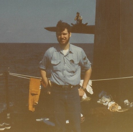
This was taken in 1982 in an area called the Tongue of the Ocean (TOTO) in the Bahamas. I'm on the USS Simon Bolivar SSBN 641 Gold at the forward end of the missile deck port side. I had just finished my watch on the Radar and ESM in time for a quick photo at the end of a very rare SSBN swim call.
Oh, and the cheek part- I'm sporting a beard. Beards were somewhat of a tradition in U.S. Submarine Service until the Navy did away with them service wide in 1985. They seemed to interfere with the EAB/OBA (face sucker) drills. Now the Canadian Navy is considering the same ban on beards (Intel Scorce: The Sub Report).
Still have the beard only a little grayer.
Volunteers keeping our shipmates informed.

TheSubReport.com
In the tradition of the all volunteer Submarine Service, The Sub Report has started a new program to help keep our community informed.

The Sub Report Field Reporter Program
I've signed on as well as many of my fellow bloggers and others who cover submarine related subject matter. If you work in or around the Submarine Community or have a passion for Submarine history and/or current events you may be interested in this opportunity to keep your shipmates and friends informed.
Here is the Link to The Sub Report Field Reporter Program.
U.S. Submarine Service - All volunteer for over 100 years.
Tuesday, April 26, 2005
From Chernobyl Disaster to Nuclear Submarine Disposal

Chernobyl April 26, 1986
So with that in mind, and other nuclear disasters relating specifically to Russian submarines, think about this recently floated proposal . The St. Petersburg Times reports that Alexander Rumyantsev, head of the Federal Nuclear Power Agency, or Rosatom wants to help the West dispose of its old nuclear subs.

Idle Russian Nuclear Submarines.
The Russians decommissioning and disposal of nuclear submarines has concerned the West for years. But now they think they can make money off the West (Russian Capitalists?) with lower costs and higher efficiency.
Never mind the classified technology concerns, their previous safety record makes me think "That's one Crazy Ivan!" proposal.
Monday, April 25, 2005
"It is the east, and Juliet is the sun."
It was somewhat of a traumatic experience (not the Shakespearean kind) for my 5 year old who has been to other warship museums with no issues. Maybe it was because it was a "Bad Guy Submarine" but I think it was the safety video before the tour. Part of the safety video is how to get off the boat if an alarm sounds, didn't like the alarm noise and covered his ears.
Well after couple of tries of "the alarm not going to sound" he agreed to indulge his dad and go belowdecks, but in the aft part of the forward torpedo room got scared again. That's when we meet Dave and Ric a couple of Subvets in coveralls from the Cobra Foxtrot sub that was in Seattle and is now distend for San Diego. They were on the Juliett to help in some repair and maintenance having worked on the Foxtrot and having experience with a Russian boat.
Ric and Dave were great, they saw my son's distress and immediately came to my assistance. I explained that my son was concerned that the alarms were going to go off and he didn't like the noise. Dave (the one with the hat that said Cobra COB on it) tells my son "the alarms don't work, we're here to fix them". That did the trick and he was fine after that. Now he wants to go back again to see the bad guys submarine.

Juliett 484 in Providence (Source: Juliett 484 Museum Website)
As a cold war relic this is a pretty cool thing to see. These boats were the precursor to the nuke class Echos (pun link for echo). They carried SS-N-3 cruise missiles capable of delivering a tactical nuke to a range of 400 miles. The Soviet version of the Regulus boats. NATO had some real concern about the Julietts in the 60's. These boats were some of the first to have a rubber coated hull and were very quite when running slow on aux electric motors. Early on they were tasked for a nuclear strike role but were later used to shadow NATO Naval groups and Carrier tasks forces. Key weakness was it had to surface fire the SS-N-3.
There is lots of history surrounding the one in Providence. It's owned by the group (The USS Saratoga Museum Foundation) who's trying to get the USS Saratoga set up as a museum in Rhode Island. There is some antidotal evidence that it may have shadowed the Saratoga during its career. It was also used in the film K-19 the Widowmaker.
All and all worth a look for any Submariner interested in Cold War history. As Ric one of the Subvets said on Rontini's Submarine BBS "It's an A-Gangers wet dream."
Без перевода.
Thursday, April 21, 2005
Chart 81023 and Discol Waters Rep
One more post on charts and the USS San Francisco grounding. I obtained a copy of chart 81023, the primary chart reported to have been used by the SSN711 Navigation crew, just to see what information it contained.
In my previous post “Anatahan to Guam to Discolored Waters” I had annotated chart 524 (a very large scale chart, which I had at the time) with some additional information such as Latitude and Longitude of some points of reference. On Chart 81023 I have done the same, additionally soundings are in meters so I converted some of the soundings to fathoms using 1.8 meters per fathom. For more accurate conversions between fathoms, meters and feet go here. The infamous 'Discol Waters Rep' is highlighted in the center of the chart section with Lat and Long.
Area of interest on Chart 81023 Modified (Click Image to enlarge)
In the previous post I had made an assumption on the Subs general course by saying.
From what the chart indicates in sounding data (in fathoms) the most reasonable and least obscured transit (in red) would have been west of West Fayu and Satawal islands and east of Lamotrek islands.
In the comments section of that post Bubblehead of "The Stupid Shall Be Punished" blog had pointed out that the course was probably more easterly. Now that I have looked at chart 81023 I agree. My projecting of the course west of Satawal Island was a serious error. Chart 81023 shows shoaling water of only 40 and 15 meters (21 and 8 fathoms) just southwest of Satawal. This sounding data was not on chart 524. A course east of Satawal is a clearer path (green annotation line) to take although it is closer to the discolored waters report area.
Obviously the Sub's Navigation team would not have used chart 524, which is all I had at the time of my previous post , but my error demonstrates that chart selection and the resolution of it's data points are a critical part of voyage planning for a submarine.
Chart 81023 may not have been the only chart in use at the time of the grounding, but here are some observations relating to data points and resolution that may help in understanding the situation.
1) Soundings between West Fayu and Satawal Island are 15 to 20 miles apart.
2) Distance from West Fayu to Satawal is about 48 miles with only a couple of sounding in between.
3) Distance between Lamotrek and Satawal about 40 miles with 5+ sounding in between.
4) Distance between Satawal and discolored waters report is about 25 miles with one sounding point close to Satawal.
5) The nearest sounding point to the discolored waters report is about 10 miles to the east at 1335 meters.
6) There is no sounding data for 20 miles to the west, northwest and 15 miles to the southwest of discolored waters report.
Looking back some would say more caution should have been exercised by the crew, but I'm of the opinion that bad luck and poor data played a major roll in the incident.
In saving a crippled SSN 711 the CO and crew demonstrated the courage and professionalism that exemplifies wearing US Submarine Dolphins.
The only other thing I will add is:
May god bless U.S. Navy Machinist's Mate 2nd Class(SS) Joseph Allen Ashley
Update 4/22/05 8:30 - The New London Day (registation after today) has additonal information on the Navy's investigation report including the use of chart E2203 and not 81023 as was previously reported.
Monday, April 18, 2005
"How 'bout them Boing Fish?"
It first I thought I was going to get hooked into another fish story joke or someone thought my sea story was Boring and couldn't type. I did a quick Google and found the Dwarf Minke Whale who makes the cool Star Wars sound and is sometimes called the boing fish, check out the sound it makes here or here.
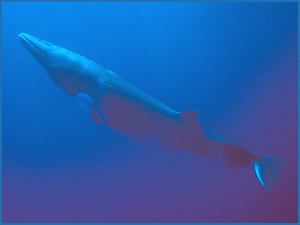
Dwarf Minke Whale (Photo: Queensland AU gov website)
If your interested in some more Dwarf Minke Whale Photos go here.
The origin of this boing fish sound was a mystery for 50 years until recently. Now I have a new mystery, did the anonymous comment from Sonarmen!
Shipbuilding and Submarines at risk in New England
New England’s shipbuilding industry has designed and produced some of the world’s finest warships. From The 44 gun frigate USS Constitution to the modern Virginia Class nuclear fast attack submarines, New England shipyards have produced almost every type of warship that has served in the US Navy including submarines, frigates, destroyers, cruisers, battleships and carriers.
The Navy has also had a long established use of the natural harbors along the New England coastline including New London CT, Newport RI, Boston MA and Portsmouth NH.
But the association between the Navy and New England has been in decline since after the Vietnam War and more recently the end of the Cold War. In the current political climate the emotions of tradition and a history of efficiency and success could have little bearing. New England stands to lose more naval installations and shipyard capacity yet again.
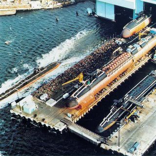
General Dynamics Electric Boat (Source: US Navy Photo)
The two things that make me think that this region is going to take a significant hit again. One is almost certain, that being the Navy’s reduction in the procurement of DDX Class Destroyers and Virginia Class Nuclear Attack Submarines. Fewer DDX Destroyers affects the Bath Iron Works and fewer Virginia Class SSNs affects the Electric Boat shipyard. With little or no commercial work both shipyards will have to reduce their workforce. This typically would impact the least skilled and least productive workers first. But there is a point where the retention of higher skilled and therefore higher paid workforce affects the cost of production and must be reduced to maintain a profit for the shipyard. At that second workforce reduction point is where capacity and shipbuilding talent is lost, possibly never to return.
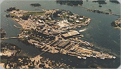
Portsmouth Naval Shipyard (Source: US Navy Photo)
The second risk is the forthcoming BRAC commission recommendations for Naval Base closure and realignment. Two facilities are up for consideration, the Portsmouth Naval Shipyard and New London Submarine Base. Both installations are some of the oldest in the Navy. Portsmouth Naval Shipyard is the oldest naval shipyard operated by the Navy and New London submarine base is America’s oldest sub base.
Departing Submarine New London Sub base (Source: Navy website)
The BRAC process is to look primarily at the military value of the installations in question with secondary consideration to the economic and environmental impact to surrounding communities. So will the BRAC process be entirely non-political, not likely. The BRAC commission itself is a political animal, appointed by the president and consisting of retired flag officers and former politicians. The following is the lists of appointees:
Anthony J. Principi, former secretary of veterans affairs, from CA, chairman.
Former Rep. James H. Bilbray of NV.
Former Assistant Defense Secretary Philip Coyle of CA.
Retired Adm. Harold W. Gehman Jr. of VA.
Retired Air Force Brig. Gen. Sue Ellen Turner of TX.
Former Rep. James V. Hansen of UT.
Retired Army Gen. James T. Hill of FL.
Samuel Knox Skinner of IL, former chief of staff under President George H.W. Bush.
Retired Air Force Gen. Lloyd Warren Newton of CT.
These commission appointees bring to the table their own set of regional and service specific biases. Just as I have my bias toward for eastern Connecticut and southern Rhode Island, so too would a retired admiral from Virginia or Representative from California have his bias favoring eastern Virginia’s tidewater area or San Diego respectively. It is hard not to be influenced in some way by your previous experiences. This would be especially true when what is at stake in a base realignment will result in the loss for one community and gain for another.
The next key point in the BRAC process timeline is just one month away on May16, 05. At that time the Secretary of Defense Donald Rumsfeld will make his recommendations to the BRAC Commission and the congressional defense committees for base closures and realignment. One of Rumsfeld’s focus as Secretary of Defense has been force transformation inter-service utilization of assets, look for this to be a key aspect in his recommendations.
Other key points in the BRAC process timeline are as follows.
July 1, 05 - Comptroller General’s analysis report of Secretary of Defense Recommendations.
Sept 8, 05 – BRAC Commission’s Recommendations to the President.
Sept 23, 05 – President’s Approval or Disapproval of Commission recommendations.
If the President approves the recommendations then the Congress has 45 legislative days to act in on that approval.
Oct 20, 05 – Commissions Revised Recommendations
Nov 7, 05 – President’s Approval or Disapproval of Commission revised recommendations.
Apr 15, 06 – Commission terminates.
With a reduced fleet size and what submarine refit and repair work that exists being sent to keep the construction yards operating I see Portsmouth Naval Shipyard at greater risk than the New London Submarine Base. But, this is not the first time New London was on the hit list. In 1993 the DOD recommended the Submarine Base for realignment but the BRAC commission choose to keep the base open.
The military's presents in New England is declining and may continue to do so. This may be cost effective in the short term but in the long term I feel it will reduce America's capacity to defend itself and a key region of the country.
Update 04/18 - 2100: Bothehook makes and excellent point on how commuity support or lack there of can influence the military's decision process. Additionaly, The Sub Report links to two articles from the New England press here and here about the possible closure of the PNS.
Thursday, April 14, 2005
Animals and Submarines
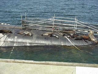
#1 (US Navy Photo)
Trim Party on the turtle back .
All right, who blew sanitaries on me.
Duty officer, we need some Sea Lion handlers topside.
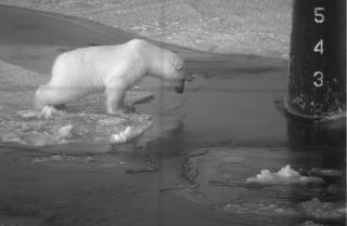
#2 (US Navy Photo)
BEAR-ing mark!
I think these submariners have a screw loose.
Just waiting for a SEAL.

#3 (Source: Unknown)
I know, we'll keep him in the Goat Locker.
Chief Billy meets the mess cooks, tonights meal?
Challenge: Add your own captions in the comments section referencing the Photo #.
Keep it clean we don't want to offend anyone.
Sunday, April 10, 2005
From Anatahan to Guam to Discolored Waters
Topography
First an update on recent geological activity in the Marianas Island north of the Caroline Islands and Guam. On April 7 a major eruption occurred on Anatahan Island approximately 215 miles north of Guam at 16°35’N lat and 145°67’E long. The satellite photo below shows an plume from the Anatahan volcano as well as the volcano's relationship to Guam.

Anatahan Volcano ash plume 4/7/05 - Maranias Islands
(Photo source: NASA GSFC, MODIS Rapid Response Team)
Anatahan volcano is the most active of the 12 major volcanoes in the Marianas Islands. This is the forth eruption of Anatahan in the past 2 years and further evidence of the intense geological activity within 600 miles of the USS San Francisco's grounding and in line within 2 degrees of the Longitude for the reported "Discolored Waters" area.
Charts
In a recent article "Navy Faults navigational procedures In crash Of Sub" in The New London Day (registration required) by Robert Hamilton some of the assumptions I had made in my previous post have now been reported on. I had listed 5 charts with Notice to Mariners that were of interest. Chart 81023 is reported to be the specific chart used by SSN711's Navigation division for the transit through the area where the incident occurred. The most current chart 81023 is edition 5 with Notice to Mariners - 42/1989, 12/1990, 01, 34/1993, 41/1995, 10, 46/1996, 18/2002, 06/2005-- chart named area -Nomoi Islands. This chart covers a relatively large chuck of ocean of approximately 10 degrees of Latitude and Longitude with a listed scale of 1:1,000,000.
A second point I had made is that the first reported position of the grounding was 360 miles SE of Guam. I had calculated that the disclosed position of the "discolored Waters" 7° 45' N Lat and 147° 12' E long was actually 401 miles from Guam. The Day article reports:
The San Francisco left its homeport of Guam on Friday, Jan. 7,
headed for Brisbane, Australia. The next day, a little more than 400
miles southeast of Guam, as sailors were sitting down to lunch, it
slammed into the sea mount in an area where official Navy charts
list 6,000 feet of water.
In order to understand the San Francisco's track and area where the grounding occurred I located an even larger chart than 81023 (Chart 524 of the western pacific) and attempted to plot the subs track. Disclaimer: Below is only a guess based on the information I've read thus far and I have no insider details. Click on chart for a larger picture.

Possible SSN 711 course (Modified section from Chart # 524)
In adding my annotations to the chart I first plotted the "discolored waters" position, represented the brown box in the center of the chart. Second I found the positions of the nearby islands for reference - Lamotrek Island, Satawal Island and West Fayu Island . From what the chart indicates in sounding data (in fathoms) the most reasonable and least obscured transit (in red) would have been west of West Fayu and Satawal islands and east of Lamotrek islands. This would have put the "discolored waters' area some distance east of the track and northeast of Satawal Island. If the sub had just gone to flank and the charted water depth was 1000 fathoms I would reason that they may have passed or been near Satawal island. this is where the charted depth (admittedly on a larger scale chart) is increasing past 6000 feet. I have highlighted in yellow the 1000+ fathom sounding just south of Satawal. Not knowing the exact position on the grounding I made a yellow box around the potential area of interest.
More on The New London Day article
On "The Stupid Shall Be Punished" Bubblehead has a post on the same New London Day article that I reference above. His take is that someone in the Navy may be spinning the San Francisco grounding story to Mr. Hamilton. Bubblehead's point seems to be that much of what was cited against the Navigation crew was not out of the norm for other operational boats such as occasional mismatched soundings at flank. Not knowing any of the details and the fact that the "discolored waters" reference was never officially part of any chart or a Notice to Mariners I tend to agree with Bubblehead on the spin point. I have yet to see any specific fact cited that would have prevented the grounding. Much of the blame seems to be attributed more on poor judgment by the crew than any solid evidence of negligence. This is probably why most of the Navigation division's NJPs were only a loss of a single level in rank and not something more severe.
If indeed someone is spinning the story at the expense of the Navigation crew, for what purpose? Here's one thing I found in Mr. Hamilton's piece that may be a reason.
The Navy has been criticized for not issuing updated charts if it
knew of a possible hazard to submarine operations in the area. But
updates are expensive and take time. The agency that would make the
changes has been kept busy in recent years on other work, such as
terrain mapping in Afghanistan and Iraq, where accurate maps are
critical to land operations and cruise-missile strikes, the sources
said.
Is this just a statement of fact or a little CYA with the “kept busy in recent years on other work” statement?
Timing was everything
One last point I like to make. If the sub was traveling at 30 miles and hour and taking soundings every 15 minutes, they would cover 7.5 miles in that length of time. Not much time to detect the near vertical wall the sub impacted. 1000 fathoms to less than 100 all in the course of what was a few miles is a pretty quick ascent if you ask me.
Friday, April 08, 2005
Catfish or Dogfish?
Just an observation but the 3 former Submarine Officers who’s blogs I enjoy reading seem to all be cat people. Bubblehead here, Willyshake here and Chap here all have blogged about their cats.
Now I’m a dog person, and not those little rat dogs you see riding with old ladies, but real dogs the working kind. There’s a photo of my dog Barney a full blooded Chessy who loves the water.
Barney the Chesapeake Bay Retiever.
To have a little fun with the cat dog thing I thought I’d do some comparisons based on those observations. Catfish being those aforementioned former Fast Attack Submarine Officers (my assumptions) and Dogfish being this former enlisted Boomer sailor.
The clever Cats – SSN Characteristics
The hunter that prefers to stalk its prey by stealth.
A small and agile predator
Can be finicky and may choose the more tempting prey over an easy meal.
Independent minded .
Plays with its adversary and enjoys the game of cat and mouse.
The big bad Dogs – SSBN Characteristics
A lone wolf – ever patrolling its territory.
Resolute defender of his home.
Acts on his master’s commands – alert 1, alert1
May seen lethargic until provoked – beware, let sleeping dogs lay.
So I'm interested to see your preference, are you a Dog or Cat person and do you prefer SSNs over SSBNs. Click on the Take My Poll! icon below. 
Trying this poll thing again. Sorry if didn't work for you the first time. I've changed the polling service and it seems to work a lot better. I also turned IP checking off to allow multipule votes from one IP address, just in case your a Florida moveon.org type voter. You can also add comments to your vote as well.
Thursday, April 07, 2005
Biologics and the Milamore Fish
During one quite mid-watch I struck up a conversation with a junior officer JO who was standing the Officer of the Deck OOD. I noticed that when the watch was routine (no drills scheduled) he liked to turn up the passive sonar speaker on the conn and listen to the local biologics. In my conversation with the JO I found out that he had a master’s degree in Oceanography and marine biology. One of the things he liked to do was listen to the biologics and try to identify what was making a specific sound. Being curious I asked if he could teach me to ID a few of the sounds.
After listing to a few clicks, moans and whistles he would identify the species of marine life producing the sound. It was all pretty interesting to me having been an avid salt water fisherman. All of a sudden I hear a series of load *POPS* and immediately asked what made those sounds. The OOD says as a matter of fact “Oh, that was a Milamore fish”. I had never heard of a milamore so I had to ask him to explain what a milamore was. Here’s what I got for my trouble.
“The milamore fish is a long slender fish much like a mackerel and travels in large schools. Occasionally when spooked the lead fish in the school would stop abruptly causing the fish that were following to rear end each other and thereby put their head up the butt of the fish in front of them. When they were able to extricate each other you could here the POP sound for A MILE OR MORE.”
Very funny, he hooked me on that one. Before leaving control, a little less gullible, I promised the OOD the next time he had me as the ESM operator at PD I’d make sure to report all the hammer4 and henweighs I could. What’s a hammer4, to strike nails. What’s a henweigh, about 4 pounds. NATO classifications and naming of Soviet equipment sometimes made about as much sense as henweighs and hammer4s but a fish a named a milamore? I should have heard that one coming, well ah, maybe by a mile or more.
Tuesday, April 05, 2005
Sleeping next to a dud?
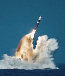
Trident Fleet Ballistic Missle (US Navy Photo)
The debate on the W-76 flaw is not new, in fact the Albuquerque Journal had an article on this back in Oct 04 and the Free NewMexican in July of 04.
So did I make patrols with a bunch of duds? Not likely. The problem appears to be with the secondary detonation which makes things boom even louder. Not much comfort if you were on the receiving end of a still multi kiloton nuclear detonation.
Sunday, April 03, 2005
Seamounts, Escarpments, Guyots and SSN 711
The exact position of SSN711’s grounding is classified but it is has been reported that the incident occurred approximately 360 to 400 miles southeast of Guam. Additionally the National Geospatial-Intelligence Agency has reported that a “discolored waters area” that appears on a 1999 Landsat satellite image could be a previously uncharted seamount. The position of the “discolored waters” area in question is reported as 7° 45.1’ N Latitude and 147° 12.6’ E Longitude. Guam, where the USS San Francisco started its voyage, position is 13° 27’ N Lat and 144° 13’ E Long.

Micronesia (Source: CIA - World Factbook)
Each degree of Latitude is 60 nautical miles and at 10 degrees Lat each degree of Longitude is still 59 nautical miles (Cos Longitude x 60). Using pythrethrum theorem A2 + B2 = C2 we can verify the distance between Guam and the Seamount. Where A is the difference in Lat miles (13 – 7) x 60 = 360 miles and B being the different in Long mile (147 – 144) x 59 = 177 miles we can calculate the diagonal distance. I came up 401 nautical miles between Guam and the reported Seamount position. I hope I did the math right on this, but it matches the upper end of the reported distance from Guam where the sub grounded. This is essentially the area between Guam in the Marianas Islands and Caroline Island ridge of Micronesia.
The area transited by SSN711 has some of the most extreme changes in bathymetric topography in the world. In fact Marianas Trench just southeast of Guam has the deepest point in the worlds oceans at 38,518 feet deep. To put that in perspective the elevation of Mt. Everest is only 29,035 feet above sea level. As an illustration I included the below hydrographic image of the western pacific that include the sub's transit route.

Pacific Bathymetry relief (Source: National Geophysical Data Center)
In the below image I took a section of the above NOAA relief and given reference location of Guam and the Latitude of 0° for the bottom of the image I was able to create a very rough illustration (yellow box in next image) of where the sub could have struck the seamount. Click on any image for a larger view.

Hydrographic with SSN711 estimated track (Modified subsection of previous relief)
I took three reported facts into account in adding my notations above. First the general direction of the ship’s transit was on a southeast heading. Second the distance of 360 to 400 nautical miles from Guam and last the accident occurred before reaching the Caroline Island Ridge. Now none to this is exacting only my best guess. The actual position could be a little further south than I indicted.
Seamounts and Guyots are volcanic in origin and the Marianas chain is volcanically active. A large number of the Caroline Islands are also volcanic in origin but do not have any active volcanoes. The Caroline Islands did have a 5.8 earthquake in 1998.

South Pacific Volcano breaking ocean surface. (Source: Volcano World website)
This photograph was taken by CSIRO - Australia.
The above photo although not from the area of the grounding does show how an active underwater volcano can abruptly appear. The underwater topography of the western pacific is a dynamic and changing environment.
The damage to the sub from the grounding was significant and appears to come from what could have been a near vertical face of the seamount.

USS San Francisco damaged bow section. (Source: US Navy Photo)
So what do the charts say about the area in question? I was unable to find any Navgation charts of the western pacific at my local boatyard ship's store and had to order a chart on-line . I haven't recieved that chart as of this writing. I did look into what commercial charts cover the USS San Francisco's transit route. The following are the NIMA chart numbers and Notice to Mariners of possible interest:
Chart# Ed# Notice to Mariners
81002 6 30/1990, 43/1995, 24, 42/1996, 18/2002 --- Caroline Islands Western part
81004 4 06/2005 --- Marianas Islands
81023 5 42/1989, 12/1990, 01, 34/1993, 41/1995, 10, 46/1996, 18/2002, 06/2005--Nomoi Islands
81025 3 N38/2004 --- Military use only
81133 4 47/1985, 27/1986, 15/1988, 30/1989, 15/1991, 06, 14, 34/1993 --- Caroline Islands
It will be interesting to see what information is contained in the listed charts and Notice to Mariners. It should be noted though, that reports of the Navigation crew's NJPs cited negligence in chart maintenance, but never indicated that a specific piece of missed information would have prevented the grounding.
